
Hiking
Forest paths, trails to the summit, and backcountry adventure.
Mont Edouard has a network of marked trails that is 25 km long comprised of different levels of difficulty to discover the beauties of the resort and its backcountry. Here’s what you’ll find:
6 km of forest paths ideal for a small family walk. (Opening scheduled for June 21).
7 km of trails down the mountain for a short excursion that’s not too hard on the legs!
9 km of trails to explore the mountain and its breathtaking views.
4 km of adventure trails in the Haute-Route sector leading to the Giants’ Refuge. (Opening scheduled for July 1).
Look at the trail map below to choose your route. Access to the trails is free.
Quick overview of conditions :
Plaines sector
OPENING SOON

Mountain sector
OPENING SOON
Backcountry sector
OPENING SOON
Caution
These trails are off the beaten path, so it is necessary to be careful. Please consider the weather conditions and your physical abilities when planning your hike. Make sure to pack water, snacks, a whistle and extra clothing. Share your plans with a loved one before you leave. The cellular network can be used almost everywhere. Bring your phone on a full charge. In case of emergency, stay calm and call 911.


Description of the Circuits
Trail departures can be found at the arch of the station’s main entrance. Signs and markers will direct you to the starting points. Each trail is identified by a coloured pictogram found along the trails. In order to plan your outings, take a picture of our map before your departure. Have a great outing!
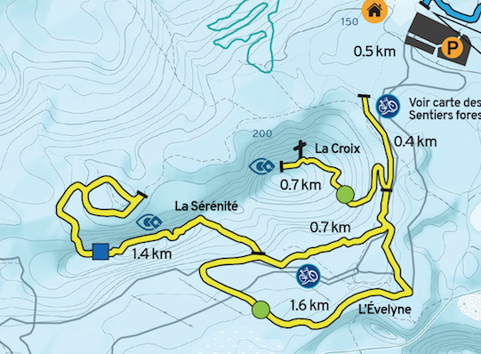
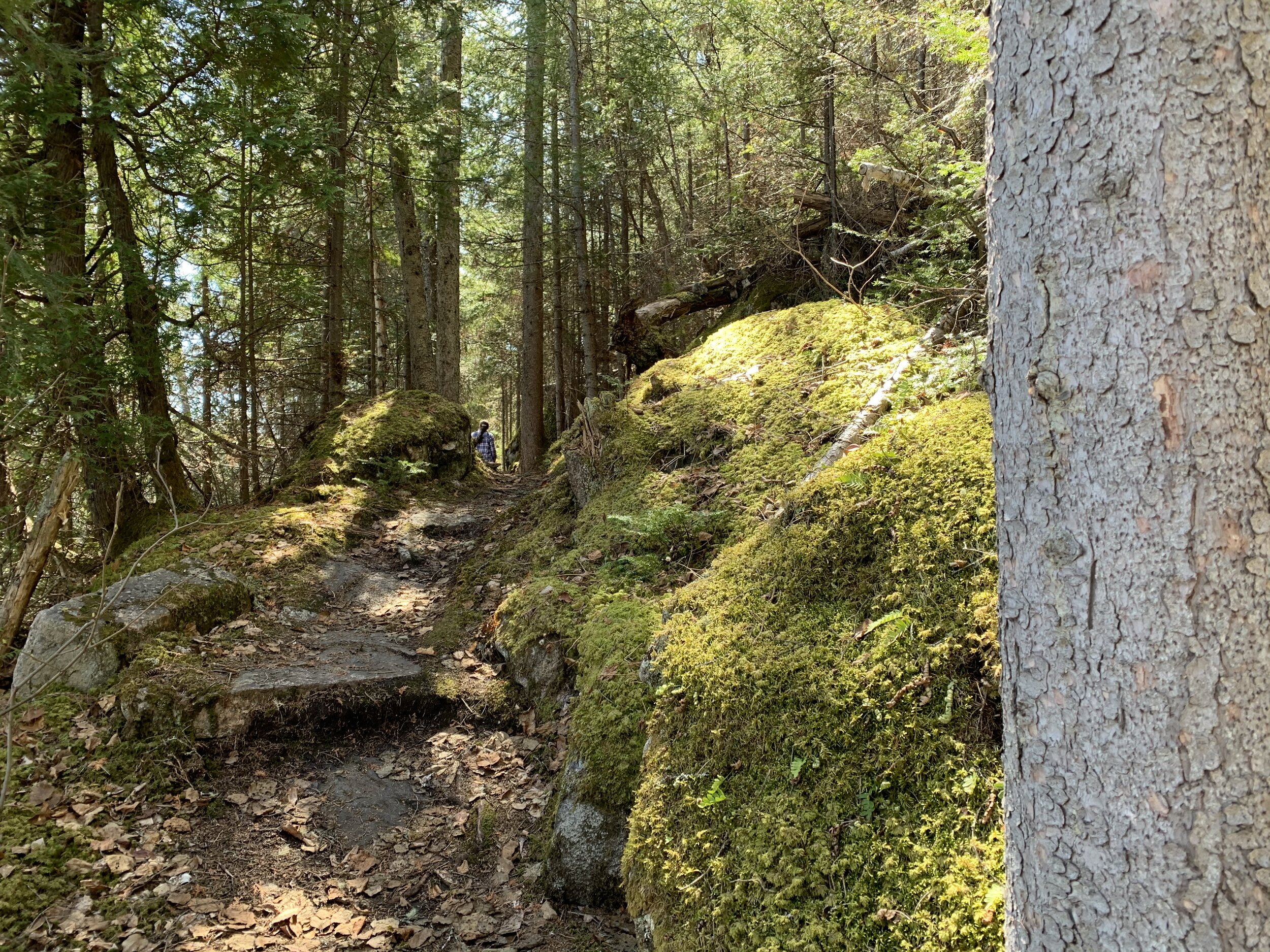
Plaines Sector
The Plains Sector consists of a forest section adjacent to the station. It is ideal for short trips on relatively flat ground.
Here are our walking trail suggestions :
Evelyne
Difficulty: Low
Distance: 2.7 km round trip
Climb: 40 m
This trail is a beautiful loop of 2.7 km passing through a coniferous forest and skirting a stream at times.
Sérénité
Difficulty: Moderate
Distance: 2.8 km round trip
Climb: 120 m
The trail starts at Evelyne and passes through a summit before descending at the foot of a rock wall. It is a cul-de-sac with a small loop at the end. The distance to and from the station with the Evelyne loop is 5.9 km.
La Croix
Difficulty: Moderate
Distance: 1.1 km
Climb: 200 m
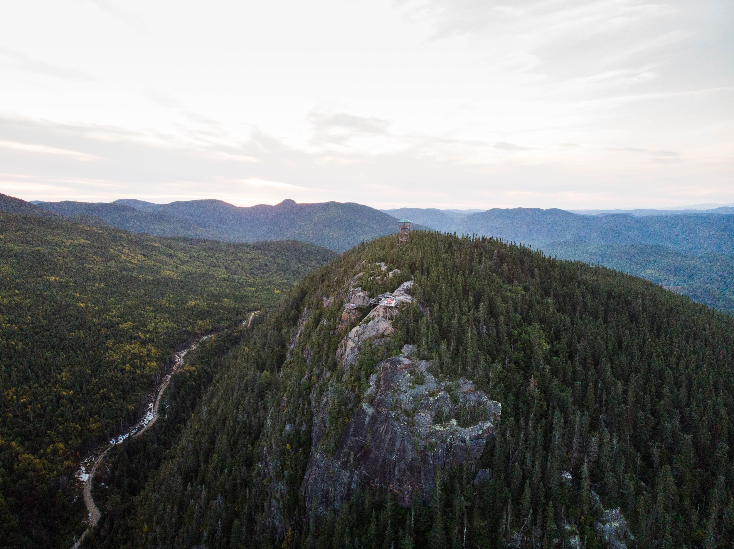
This trail starts at Angeline Gagné and goes to the summit with interesting viewpoints. Most of this trail is not very difficult except for a short stretch at the top. Note that the trail is a dead end so you have to go back the same way. The distance to and from the resort is 3.2 km.
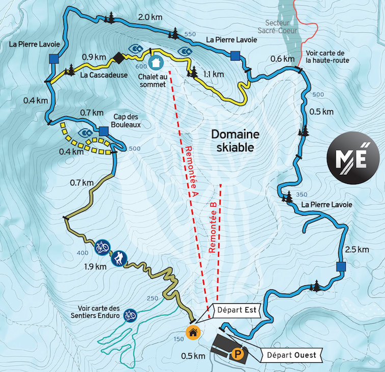
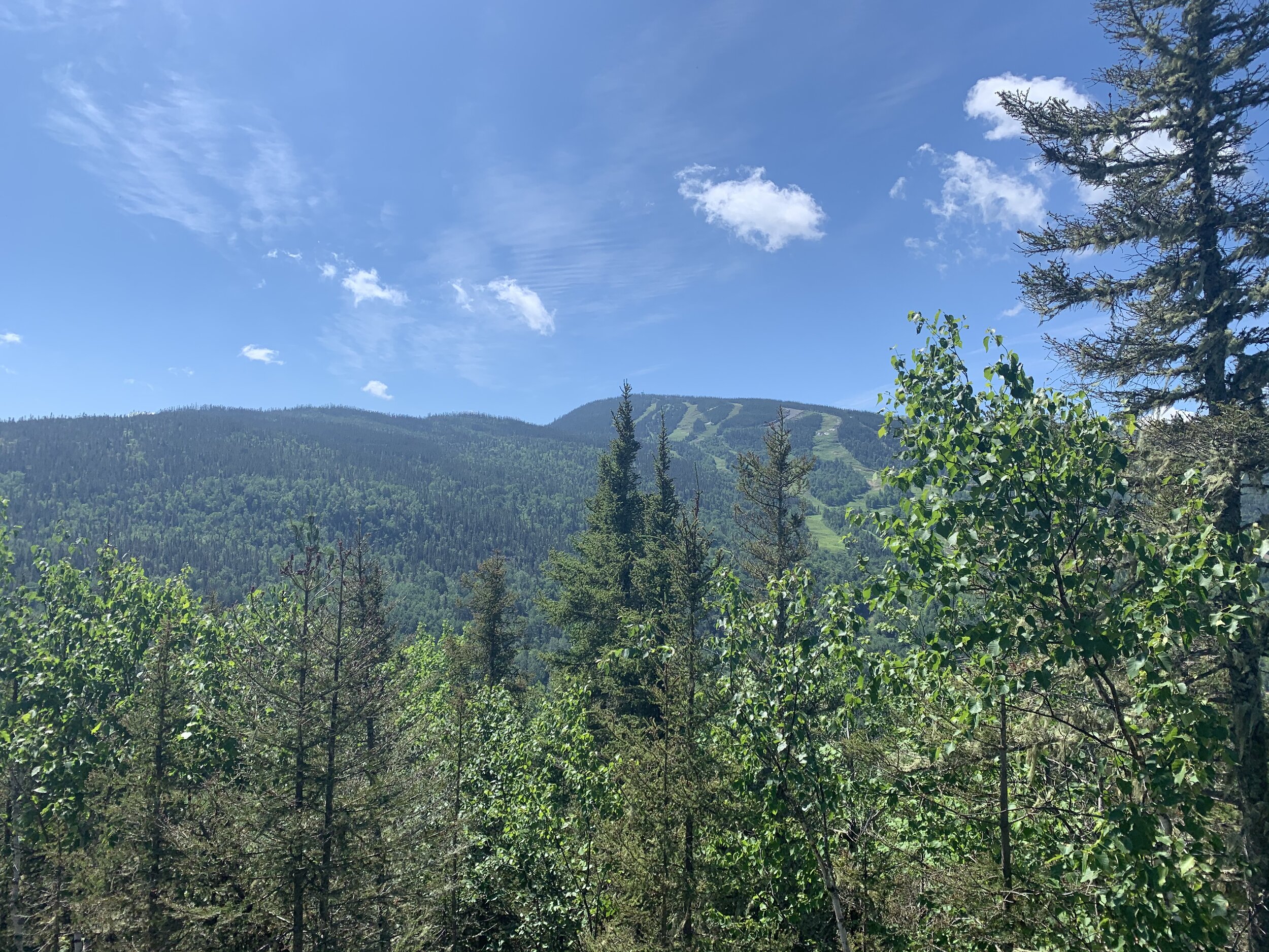
Mountain Sector
Here are our suggestions of trails to discover the mountain and its many viewpoints. These trails are marked and maintained so as to offer hikers a beautiful walking experience.
Trail S21
Difficulty: Moderate
Distance et durée: 5.4 km round trip / 2 hours
Climb: 300 m
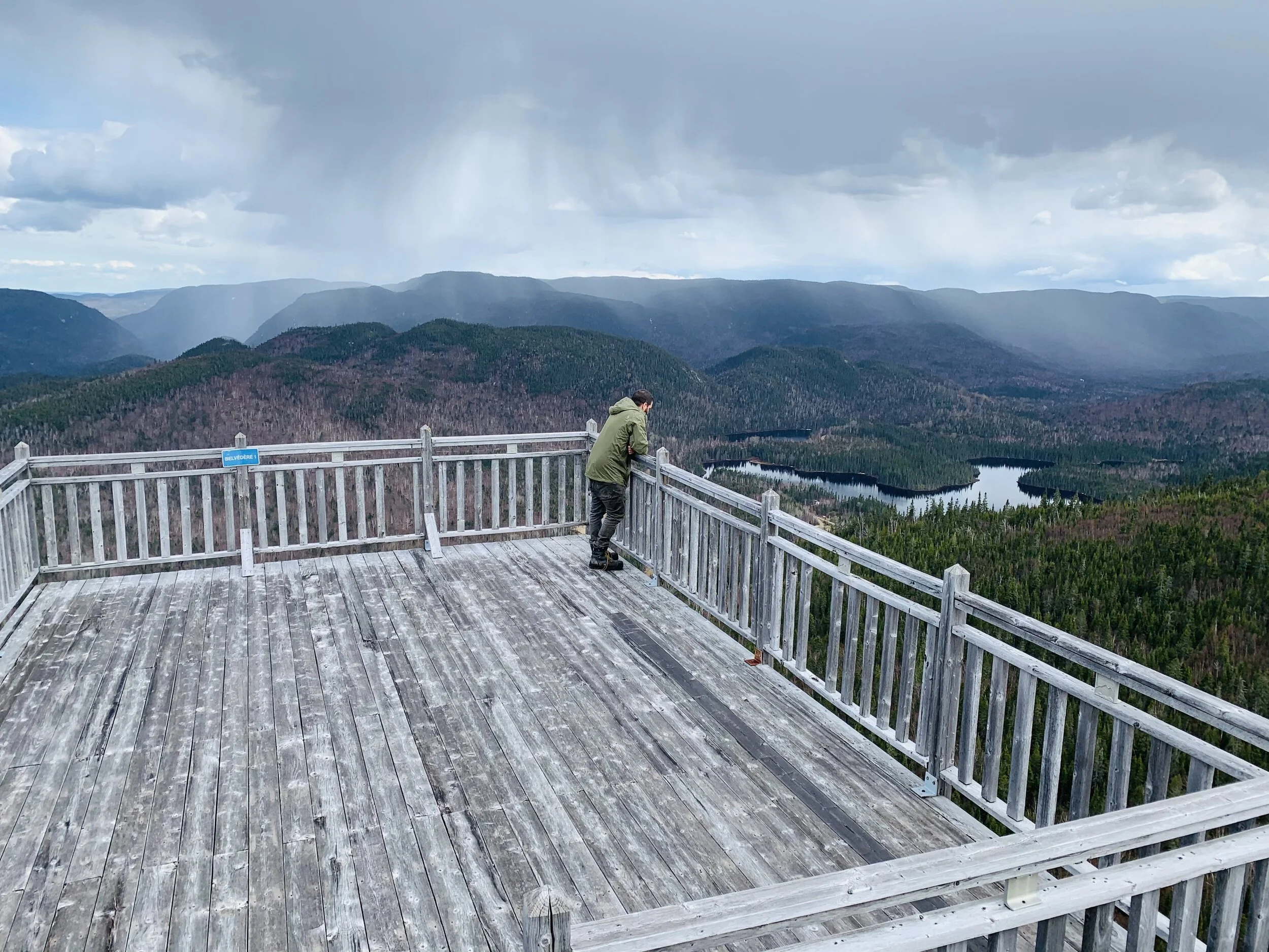
Le sentier S21 constitue une très belle randonnée pour une première sortie à la montagne. Le sentier monte en forêt et partage le sentier d’ascension de vélo enduro. Ce sentier peut-être combiné avec la section supérieure de la Launa afin d’accéder au belvédère du cap des bouleaux. Cette parois rocheuse offre un très beau point de vue sur la montagne, ainsi que l’arrière-pays de l’Anse-Saint-Jean.
Pierre Lavoie Trail (West sector) and the Cascadeuse (West sector) :
Difficulty: Moderate
Distance and duration: 9 km round trip / from 3 to 4 hours
Climb: 500 m
The Pierre Lavoie trail (Western sector) combined with the Cascadeuse (Western sector) is the best route to reach the top of the resort. This trail starts behind the ice rink, near the main parking lot. Halfway there is also the start of the high-road adventure trail towards the Giants’ Refuge.
Cascadeuse
Difficulty: High
Distance and duration: 2.7 km round trip /
Climb: 475 m
La boucle à partir de la station via la Pierre Lavoie ouest - la cascadeuse - la Pierre Lavoie est - la S21 est de 9.3 km au total avec une montée de 820 m.This trail is a more direct route to the top of Mont-Édouard from the East and West sections of the Pierre Lavoie. There is a steep portion near each summit. The section East of the Mont-Édouard summit is steep over a distance of 0.9 km. This segment is recommended for experienced hikers only. The loop from the station via Pierre Lavoie West - the Cascadeuse - Pierre Lavoie East - S21 is 9.3 km in total with a climb of 820 m.
Des Vertiges Trail
A new trail will open soon to add an ascent path on the eastern part of the mountain. This trail will be the continuation of trail S21 to the top of the station. To be continued!

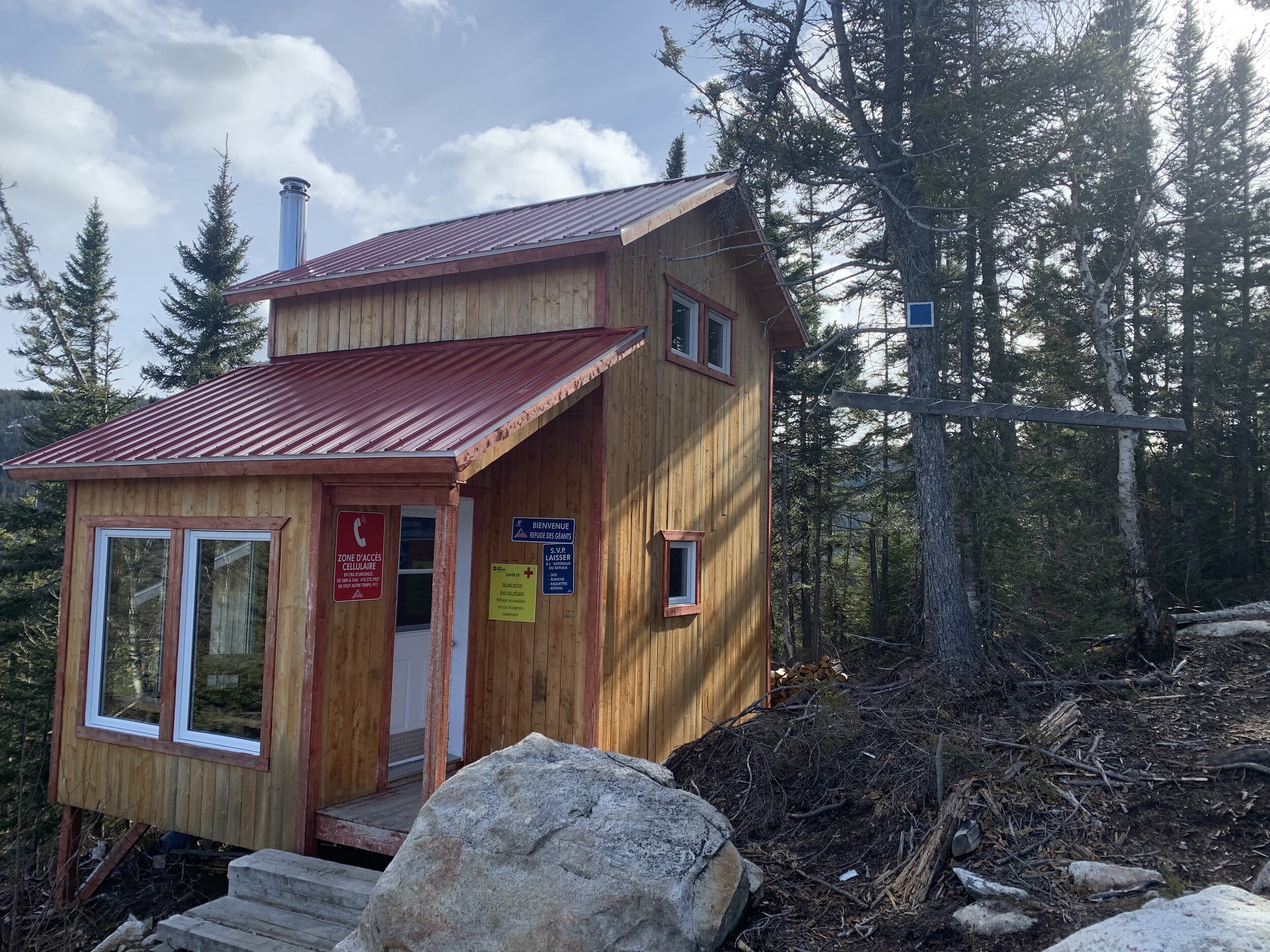
Haute-Route Sector
(Scheduled to open in early July)
Known for alpine hiking in winter, the High-road now lends itself to the summer experience. This summer, a first segment going up Sacré-Coeur towards the Giants’ Refuge will be opened with the possibility of renting the refuge for the night. This type of hiking is called adventure hiking, since the trails are less structured and require good physical fitness.
Sacré-Cœur towards the Giants’ Refuge
Difficulty : Moderate
Distance : 4 km round trip starting from the junction with Pierre-Lavoie West and the Sacré-Cœur ascent.
Climb: 350 m

Instructions
Waiver of responsibility. Mont Edouard will not be held responsible in any way for any accidents that may occur while mountain biking or as a result of any other forest outings.
Code of Conduct :
It is important to follow the Code of Conduct on the trails.
Get your access ticket via our online ticket office clicking here ;
Have your ticket with you at all times;
Have protective equipment (helmet);
Follow the signs and stay on bike trails;
Do not use the trails after heavy rain;
Find out about trail openings and conditions on this page before all your outings;
Do not descend on ascending or hiking trails;
Dogs are not permitted on bike trails;
Respect other outdoor enthusiasts at all times;
Anyone who does not respect the code of good conduct could be expelled from the site without notice and compensation from Mont Edouard.
Enjoy the trails!